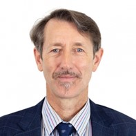
The AfricaConnect3 team speaks to Dr. Lewis about the immense power of EO in building a better future for Africa and the critical role that effective networks like NRENs have in making this happen.
Dr Lewis, why is EO data so important for Africa’s digital transformation and what are some of the real problems that satellites have been tackling on the continent?Earth Observation data is a unique and powerful source of information for understanding and managing our environment, from oceans to rangelands, rainforests to cities. The data is unique because satellites cover whole continents and they do it consistently, providing free and open data. This information is valuable to all countries, but especially to large countries or in areas where other sources of data are difficult to obtain. Globally, EO data are used to map and monitor land cover, crops, agricultural areas, water bodies, floods, wildfires, coastlines, geology and minerals, the development of human settlements and so on. With DE Africa we are positioning Africa as a continent to leverage all that international experience and fast-track African countries to be leaders in the use of EO data. The DE Africa platform also gives policymakers, researchers and industry leaders the information they need to help address some of Africa’s greatest sustainability challenges, like food insecurity, water management and effectively managing urban growth.
At your keynote speech at TNC21, you mentioned that National Research & Education Networks (NRENs) play a key role in providing connectivity for the end users to access and make use of satellite data. Could you explain more in detail why and how you see NRENs harnessing the potential of EO to make data-driven decisions for the public good?NRENs act as ‘data highways’ that connect data with people, and data with data. In recent years there has been a complete transformation in the way that people work with EO data. The data volumes have grown so rapidly that seemingly overnight we have moved from a model where the experts normally keep a copy of the data, to a model where no-one keeps a copy of the data –only cloud providers, major computing facilities and official archives have that capacity. In this world, experts –often in scientific and academic institutions -have to be able to connect to the data over networks, and NRENs are often out there as the pathfinders, so they are critical.
Furthermore, science is now a collaborative activity, at least in EO. So, networks are the way we connect people to work together.
In your experience, which approaches or methods have worked best to facilitate governmental institutions and organisations collaboration with scientists to maximise the benefits of satellite data in Africa?We all want our information to have impact. Looking back on my career, the key ingredients seem to be: an issue of importance and a high-level decision maker who is tasked with that issue; there is a recognised information shortage; there is relevant data in reasonably usable form and there is technical expertise close to the issue, to work with the data to produce important information to inform the decision process. We need to try to produce simple, reliable, decision-ready information with wide application that connects directly to issues. With DE Africa we are trying to do that through continental products such as water observations from space.
What are some of the key challenges that you are encountering in your work in Africa right now? And what viable solutions do you foresee for these challenges?Internet connectivity if the biggest challenge. Some of our users are connecting from remote locations and have challenges in accessing the platform. DE Africa is exploring how to optimise some of the tools, adding more memory for some power users and caching of some of the data for quick access. The COVID19 pandemic is making even more challenging for some users to connect from different countries. In this field, DE Africa is working with six Implementing Partners in Africa to bridge this gap. These partners are: Regional Centre for Mapping of Resources for Development (RCMRD) based in Nairobi, Kenya; L’Observatoire du Sahara et du Sahel (OSS -based in Tunisia), African Regional Institute for Geospatial Information Science and Technology (AFRIGIST -based in Nigeria) and AGRHYMET (based in Niger), Centre de Suivi Écologique (CSE based in Dakar, Senegal) and South African National Space Agency (SANSA).
In concrete terms, how could NRENs and their regional counterparts collaborate with DE Africa to overcome these challenges?One way NRENs could work together with DE Africa is to map out which of our users are experiencing internet difficulties that prevent them from engaging fully with DE Africa training or tools, and then to highlight those as areas for network improvement.
With the global COVID19 pandemic having a big toll on the African economy, how do you see the importance of EO for the continent’s ability to be resilient amid the effects of the pandemic, especially in the effort to achieve some of the Sustainable Development Goals?DE Africa has provided the outcomes through a report to the World Economic Forum (January 2021) titled Unlocking the potential of Earth Observation to address Africa’s critical challenges.
- Countries are empowered, with EO data about land, water resources, and human settlements enabling them to make evidence-based policy decisions.
- Lives are improved, through access to information that empowers governments, individuals and communities to make informed choices.
- Development activities are more effective through access to information that provides insights to better understand the root cause of issues and develop impactful solutions. Development of decision ready products, and analysis ready services to support African Union Agenda 2063 and the UN SDGs.
- Digital transformation is advanced through industry uptake and innovation using products and services from DE Africa. Increased economic development and job creation, through access to data for commercial products and services development.
- Over $2bn of benefits to the African continent are possible through accelerated industry growth, improvements in agricultural productivity and the detection and prevention of unregulated mining.
Technical change tends to be slower than we would like, but I think there are trends in play around EO data in Africa that will play out over the next decade. In 2032, DE Africa will be a global showcase on how to organise and apply EO data for sustainability and climate. The ARD collections from Landsat and Sentinel will be 10-15 petabytes in size. I hope there will be hundreds of African scientists working with these data to produce information of value. I hope that DE Africa as an institution will be producing accurate, operational continental products to help to monitor surface water, coastlines, wetlands, urbanisation and forests.
We asked a geospatial expert working at AC3 partner Institution in Egypt how they have been exploring the potential of EO in their own field to solve challenges and empower their communities.
“The advancement of satellite sensors and open access of data are playing significant role in achieving sustainable development goals and provide solution to critical environmental challenges. Radar satellite data (Sentinel 1) is significantly used to monitor oil pollution in the marine environment of the Mediterranean Sea and Red Sea due maritime shipping tankers or/and oil production platforms. It enabled to generate robust service to environment agency to keep an eye on the marine environment and take the necessary actions. Otherwise, optical satellite data and geophysical data are integrated to quantify the wastes in a large landfill in Cairo to re-develop the area.” Prof. Islam Abou El-Magd Vice President National Authority for Remote Sensing and Space Sciences (NARSS), Egypt


